 Steaming Mules
Keystone Mapping Project
Wordpress and Google API Web Application featuring interactive maps and photography
Description:
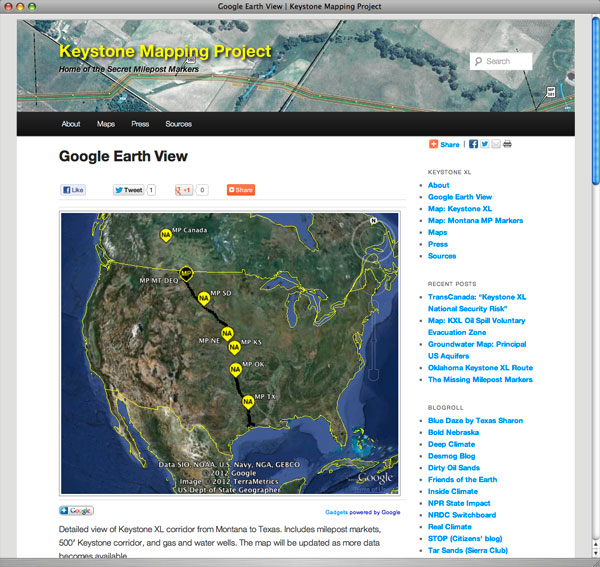
The Keystone Mapping Project is an internationally recognized photography and multimedia project featuring the most detailed publicly-available routing information for the proposed Keystone XL pipeline planned by TransCanada Corporation to run from Alberta, Canada to Port Arthur, Texas.
Features:- Open-source Wordpress platform for efficient site construciton, ease of expansion, and straight-forward maintenance.
- HTML5/CSS/JQUERY integration.
- Integration of third-party applications, including Google Analytics, Google Earth, Google Maps, and Facebook.
- Custom user-centered map styling which tailors data presentation, thus conveying very large data sets in a very efficient, readable, and expandable manner.
- Blogging, FOIA, grant writing, and original reporting and photography.